JF GOES TO AUSTRALIA (again)
PERTH TO DARWIN
via
GREAT CENTRAL ROAD
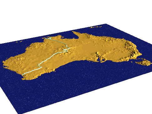
3 dimensional rendering of the route between Perth and Darwin via Warburton.
Australian elevation data from 30 second world dataset from USGS, route data from tracks recorded by GPS during the trip
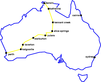
Because it's there...There is no logical reason for me to keep doing this, but I keep doing it. Australia represents a very good challenge that combines survival skills in the desert, long distances to travel, relatively short days compared to Canada's arctic in the summer, and of course, the potential for high temperatures.And these challenges come in a country with a relatively low crime rate and no language barrier AND LOTS OF SUNSHINE ! In my 5th trip to Australia, I tackled about 1200km of an outback road which links the west coast to Uluru (Ayers Rock) and Alice springs. This road was originally known as the Warburton road, and is now called the Great Central Road although some may call it the Gunbarrel road because it shares the roadway with the Gunbarrel for some distance. This unsealed road is eventually going to become a sealed road, so time is running out to experience it as an outback road. Already, many outback books have dropped this road because it is too well travelled ! ( You can expect upwards of 10 vehicles per day ). At Laverton, I put on the dirt road tyres, and embarked on a road where I was told many lost their lives. 2 permits are required to cross the aboriginal lands to reach Uluru, with the nearby village at Yulara. On this road, I passed by 5 communities (Cosmo Newberry, Warburton, Tjirrkarli, Warrakurna and Docker River, but entered none. and must rely on waterholes in between for survival. Based on map information, I must be able to survive up to 230km between water points. While I have travelled greater distances in a single day, I must prepare for a worse case scenario of travelling about 80km per day. Hopefully my camera and lens will survive the trip so that when I reach Yulara, I will be able to take good pictures of Ayers' Rock (Uluru) as in '95, one of the lens elements became unscrewed inside the zoom, rendering it rather useless, and of course, this happened just as I arrived in front of the rock. |

Getting a shot of a 'roo is not easy.
I was still in my tent in early morning for that one.
| After Yulara, I will head towards Kings Canyon which I have not yet seen, and from there, I will rejoin the Stuart highway and head north to Alice Springs and then onwards to Darwin. I then take a few days of vacation and then head back to Canada. |
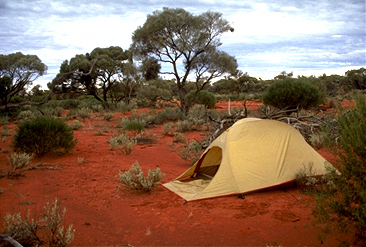
This is what a typical campsite looks like in Australia's red centre